WHAT’S CHANGED
The Winter Storm Watch has been expanded to include all of metro Atlanta beginning 1am Saturday through 10am Monday.
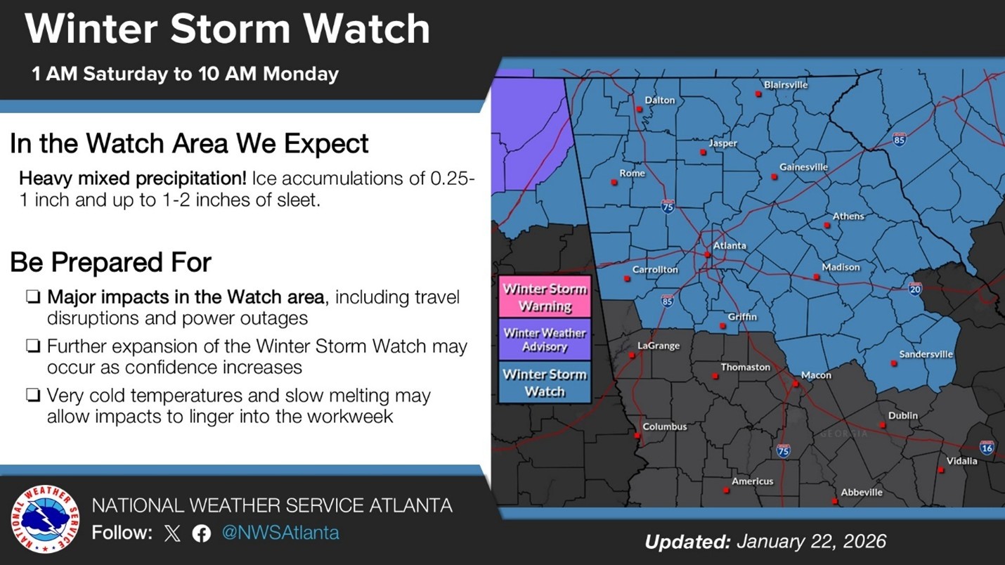
Figure 1: Winter Storm Watch Area
MODEL AGREEMENT
Models have begun to agree in general precipitation type and location, which increases confidence in the potential impacts to the area. Freezing rain is possible in the early Sunday hours as the system moves through, with a potential transition to rain as it warms up in the afternoon. There are still slight differences in timing and precipitation severity, but most agree that precipitation will likely start late Saturday evening into Sunday.
POTENTIAL IMPACTS
The graphic below shows the possible range of impacts based on ice accumulation totals. The Atlanta campus is forecast to receive between 0.10-0.50” of ice, with locally higher amounts possible. With the addition of wind gusts up to 30mph, impacts border on the moderate to major category as defined by the NWS.
These impacts include:
- Lengthy (multiple days – over a week) and widespread power outages across the region
- Downed trees on houses, overhead utilities and blocking roadways
- Travel disruptions due to ice accumulation
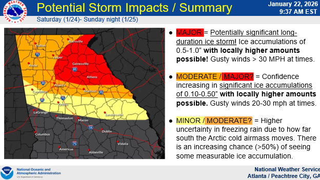
Figure 2: Potential Storm Impacts
POST EVENT TEMPERATURES
Temperatures are still forecast to rise slightly as the system kicks through late Sunday but quickly fall below freezing on Monday with a deep freeze expected Monday night through Tuesday morning. Some models suggest temperatures dropping into single digits Tuesday morning, but all models show a deep freeze over that period. This may cause further aggravation in areas hit hard by ice.
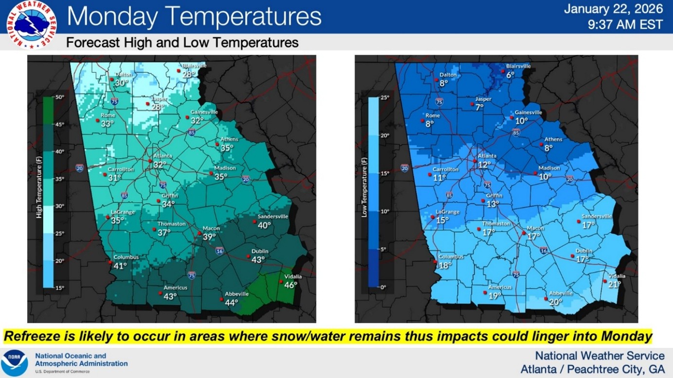
Figure 3: High/Low Surface Temperatures on Monday (1/26)
NEXT STEPS
- Emergency Operations meetings will continue tomorrow at 10AM.
- The Georgia Tech Police Department Office of Emergency Management will continue to monitor the situation and provide updates as necessary.
- Follow the GT Office of Emergency Management on twitter @gtpdalerts.
- For the latest forecast information, please visit the National Weather Service.