
OVERVIEW
Hurricane Isaias strengthened into a major hurricane overnight with winds up to 120mph. Landfall will occur late tonight near Pensacola, FL. Impacts to North Georgia and Atlanta have not changed. We are still expecting to experience significant impacts from damaging winds, heavy rain/flash flooding, and isolated tornadoes.
Light rain will begin tonight and increase in intensity throughout the day Saturday. The timeframe for most intense impacts (wind gusts, heavy rain, tornadoes) is forecast to occur between 3am Saturday – 11PM Saturday.
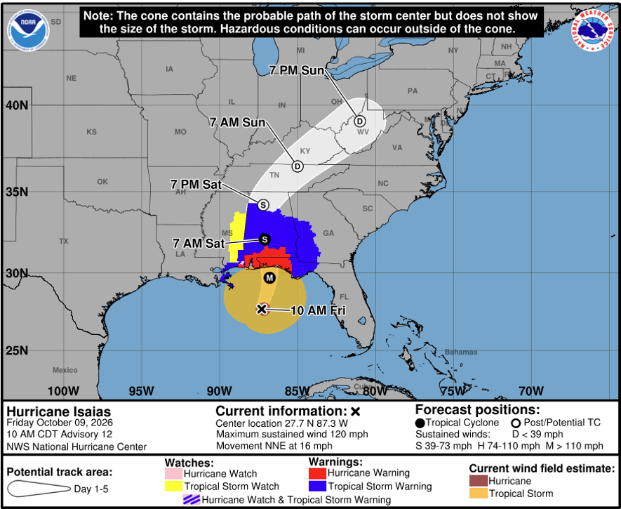
Figure 1: NHC/NWS Hurricane Isaias Forecast Cone
CURRENT WEATHER ADVISORIES
High Wind Warning
A High Wind Warning takes effect overnight tonight (12:00am) for all of North Georgia through Sunday at 8am. We are expecting a prolonged period on Saturday with winds gusting anywhere from 35-50mph. This may lead to downed trees and power lines. Scattered power outages are possible throughout North Georgia. Generally, campus is quite resilient to weather-related power outages due to our underground utilities.
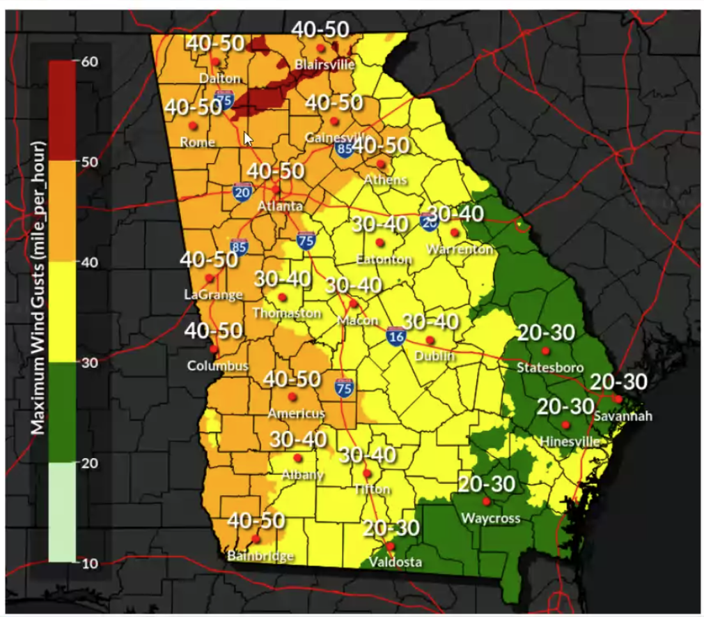
Figure 2: Peak Wind Gust Forecast Saturday
Flood Watch
A Flood Watch takes effect overnight tonight (12:00am) for all North Georgia through Sunday at 8am. Rainfall totals across the area will range from 2-4” with isolated higher totals near 5”.
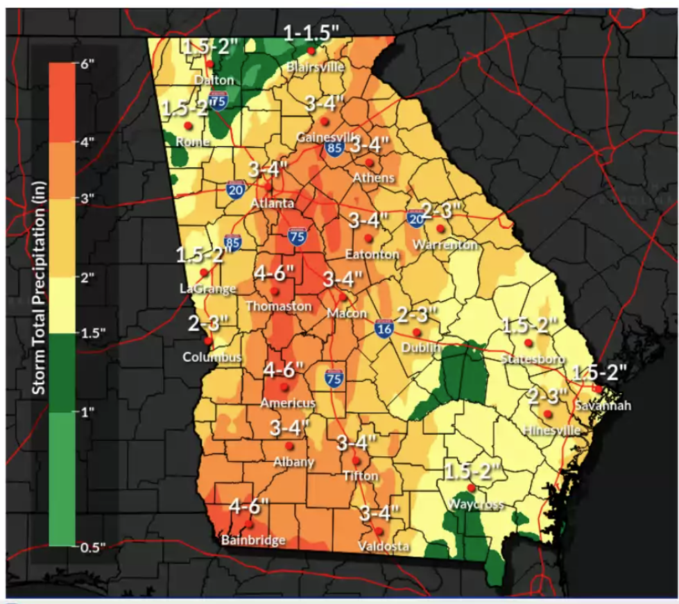
Figure 3: Forecast Rainfall Accumulation Ranges
Severe Weather Outlook
The tornado threat continues to increase. We are still outside the highest risk area; however, we are much closer to it than yesterday. Remember, tornadoes from tropical systems tend to be weak and short-lived. This does not mean that they cannot cause damage. This means that they form and dissipate quickly. You will need to take shelter immediately if campus is under a Tornado Warning. A GTENS Emergency! message will go out if we are put under a warning.
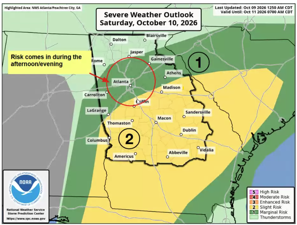
Figure 4: SPC Tornado Outlook for Saturday
OEM will continue to monitor the latest model guidance and NHC/NWS forecasts to keep the campus community updated. Make sure you are signed up to receive text alerts from GTENS. You can sign up at [passport.gatech.edu]passport.gatech.edu.