OVERVIEW
A brutally cold air mass will move back into the area on Friday night and hang around until early next week. In addition, a weak wave begins to develop into a closed low along the Gulf Coast and strengthens off the Atlantic Coast. As this low strengthens, some wrap around moisture could bring the area some light snow. Currently, little to no accumulation is expected; however, scenarios outlined below could change that.
TEMPERATURES
Below freezing temperatures for areas north of I-20 are expected for the duration of the weekend. Temperatures drop below freezing Friday night and likely will not get above freezing until Monday afternoon. This means pipe bursts are expected once we reach above freezing. The forecasted freezing temperatures can be seen in the image below depicted via the red line. Additionally, factoring in the winds ‘feels-like’ temperatures will be near to below 0° Saturday/Sunday.
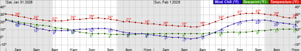
Figure 1: NWS Temperatures, Wind Chill, and Dewpoint Midnight Saturday (1/31) to Midnight Monday (2/2)
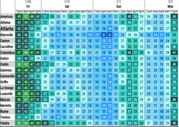
Figure 2: NWS Multicity Temperatures this Weekend
SCENARIOS
You may have also heard about the possibility of snow this coming weekend. The possibility does exist for snow, but it heavily depends on the track of a low-pressure system moving from the Gulf to the Atlantic. The National Weather Service gives us a less than 50% chance of seeing snow this weekend. If you’re looking for snow, you’re going to want to hope for scenario 2, which is a more westward track of a low developing in the Gulf. The good news with this system is that the precipitation type will be snow as we are confident that cold temperatures will persist to give us all snow and no freezing rain or sleet.
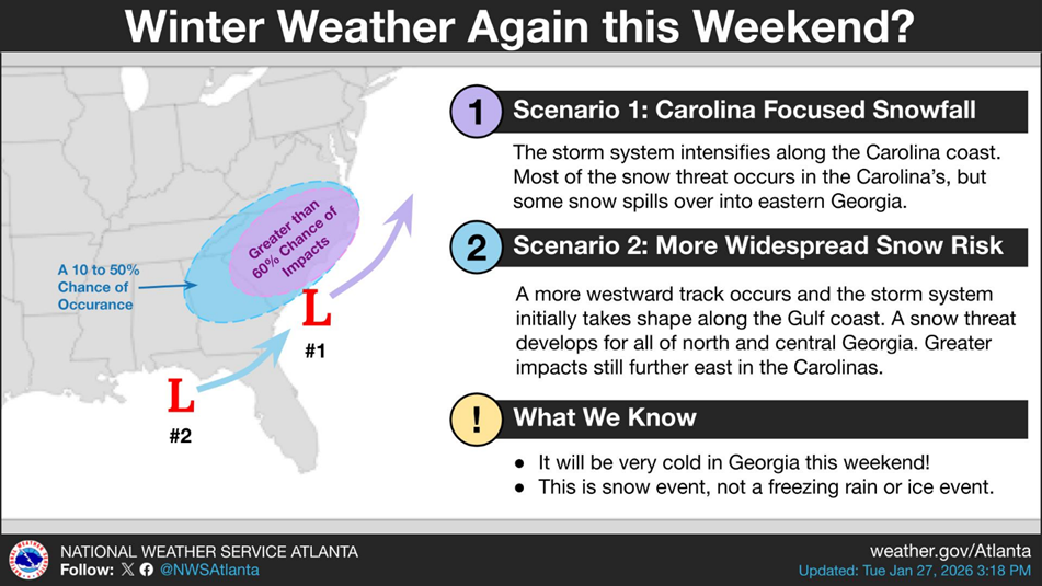
Figure 3: Low Track Scenarios
NEXT STEPS
- The Georgia Tech Police Department Office of Emergency Management will continue to monitor the situation and provide updates as necessary.
- Follow the GT Office of Emergency Management on twitter @gtpdalerts.
- For the latest forecast information, please visit the National Weather Service.