OVERVIEW
Overall, campus and most of metro Atlanta fared well through the winter storm. Only minor impacts have been reported in the area. NE GA received the bulk of the significant icing and is still dealing with impacts today. Across Metro Atlanta, roadways are in good shape with just some patchy black ice reported.
Temperatures will remain below freezing today and much of tomorrow. Not only will it be uncomfortable outside from the temps/wind chills, but gusty winds may increase power outages across North Georgia, especially in locations in NE GA where they are still dealing with ice. Even in areas that only saw moderate ice accretion/melting, the strain of the ice and the saturated grounds could make trees more susceptible to winds at this speed.
WINDS
Northwest winds gusting from 20-35mph will develop throughout the day and continue through the early evening. These winds will add additional stress to trees that experienced icing yesterday or continue to have ice. Power outages, mainly across NE Georgia are expected to increase throughout the day.
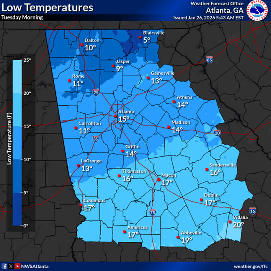
COLD TEMPERATURES
Extreme cold will impact all of North Georgia this morning through Tuesday. A Cold Weather Advisory is in effect until 9:00am Tuesday morning. Atlanta is not expected to get above freezing today and maybe make to 40° after noon tomorrow. Low temperatures tonight into Tuesday morning will be in the low-to-mid teens for much of the metro area. Temperatures this low, coupled with gusty winds, will make it feel brutally cold. Tuesday morning winds chills are expected to be in the 0-5° range. Please take proper precautions if you need to be outside. Remember to protect the four Ps: People, Pets, Pipes, and Plants.
NEXT STEPS
- The Georgia Tech Police Department Office of Emergency Management will continue to monitor the situation and provide updates as necessary.
- Follow the GT Office of Emergency Management on twitter @gtpdalerts.
- For the latest forecast information, please visit the National Weather Service.