WHAT’S CHANGED
Ice accumulation across the region is ongoing with heavier amounts north and east of downtown Atlanta. We estimate around .20” on campus at the writing of this report. Another .10” for campus is possible. The NWS expects additional accumulation, although we believe much of that will be northeast of the perimeter. The wedge set in last night just after midnight on campus and should continue to hold strong until just after noon today for Atlanta. Precipitation during that period should be light. While the wedge area will retract away from campus this afternoon, areas to the northeast will hold strong as a line of heavy rain and thunderstorms move through early to mid-afternoon (see image, below).
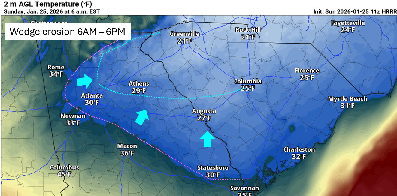
Depending upon how much the wedge erodes today, parts of Cherokee, North Fulton, Forsyth, Hall, and Gwinnett Counties and areas north and east may all see additional accumulations >.40” of ice as that line moves through. We believe that as the heavy precipitation moves through, campus and areas inside the perimeter will be above freezing at the surface and no longer support ice accumulation. Thus, while there are still significant impacts yet to be felt across the region, we are feeling more confident about campus and the immediate areas around it.
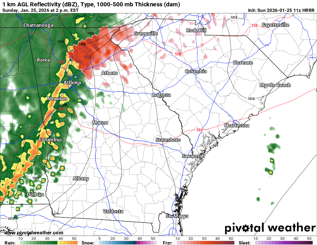
The below image shows the heavy rain and thunderstorms moving through the area by 2 PM today. The coincidence of this line and any remaining wedged areas may provide significant icing to some northeast counties.
CURRENT IMPACTS
- Power outages are relatively low thus far but may increase with additional accumulation and wind gusts. There are no reported outages on or near campus. Current reported outages in the region:
- Gwinnett County: 2,135
- Fulton County: 1,727
- Dekalb County: 1,171
- Cobb County: 551
- Road conditions are good on campus and areas inside the perimeter. Some roads, especially to the north and east are deteriorating quickly.
- Trees are starting show some of the weight of the ice, but few downed trees have been reported.
NEXT STEPS
- Institute leadership will discuss impacts and make decisions for Monday later today.
- The Georgia Tech Police Department Office of Emergency Management will continue to monitor the situation and provide updates as necessary.
- Follow the GT Office of Emergency Management on twitter @gtpdalerts.
- For the latest forecast information, please visit the National Weather Service.