OVERVIEW
Some light snow is possible overnight tonight for the Georgia Tech Atlanta campus and across most of Metro Atlanta. The biggest change since yesterday is the precipitation extent has spread more northward in some models. However, consistent with previous forecasts is that most precipitation will set up to the south of the region and will limit impacts locally. Timing is still from around midnight tonight through 8 AM Sunday morning. Also consistent with previous forecasts is that we’re only expecting light rain and snow and do not anticipate any icing.
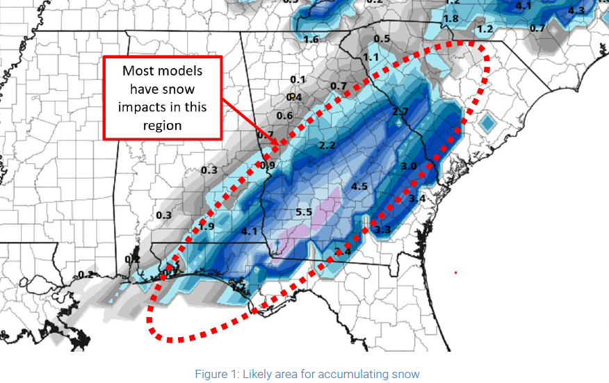
Although the latest model runs allow for some of this precipitation to extend into our region, none suggest significant accumulations here. The bulk of the precipitation (mainly snow) will set up south and east of a line from Pensacola, Fl northeastward to Columbus, GA and continuing to Greenville, SC. Areas south of that line may see significant snow accumulations; however, areas to the north of that line, including metro Atlanta, may see only minimal accumulations. The NWS has issued a Winter Weather Advisory for much of Middle and South Georgia for this period. The NWS has a Hazardous Weather Outlook issued for our area since forecasted snow totals are below Advisory thresholds.
Temperatures on Sunday should rebound into the upper 30s and possible reach 40 with ample sunshine. As such, any impacts to roadways should be naturally resolved by midday Sunday.
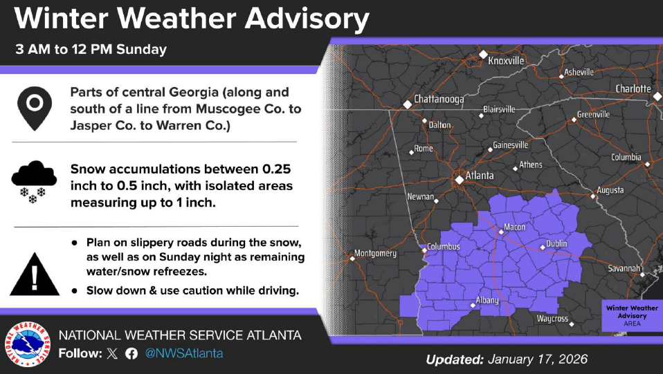
Figure 2: Winter Weather Advisory (NWS)
PRIMARY HAZARDS
Light snow accumulations on untreated and shaded surfaces
NEXT STEPS
The Georgia Tech Police Department Office of Emergency Management will continue to monitor the situation and provide updates as necessary.
Follow the GT Office of Emergency Management on twitter @gtpdalerts.
For the latest forecast information, please visit the National Weather Service.