OVERVIEW
The Office of Emergency Management (OEM) is monitoring the forecast for the possibility of winter weather on Sunday morning. Currently, most models are in good agreement on timing and location of the precipitation. Most models now keep the main area of precipitation well to the south of the metro area. So that’s bad news for snow lovers and good news for snow haters.
As described in previous communications, weather models have a hard time predicting this setup, so we do not want to give the full “all clear” on snow chances, but the likelihood is near 0%. Our most likely outcome is no snow at all or light snow flurries (no accumulation).
With all that said, please continue to monitor the weather this weekend, as well as your email for possible changes to the forecast.
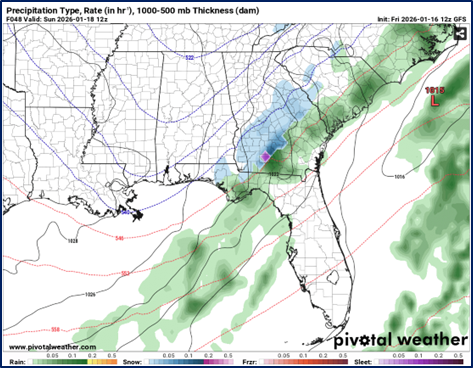
Figure 1: GFS model run from Friday 1/16 (12Z run) showing precipitation on Sunday at 7am
PRIMARY HAZARDS
- Cold Temperatures
- Holiday Travel
- If snow falls, any melt may refreeze into ice Sun overnight into Mon.
NEXT STEPS
- The Georgia Tech Police Department Office of Emergency Management will continue to monitor the situation and provide updates as necessary.
- Follow the GT Office of Emergency Management on twitter @gtpdalerts.
- For the latest forecast information, please visit the National Weather Service.