Overview
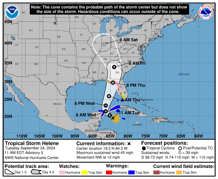
Tropical Storm Helene is forecast to become a major hurricane as it approaches the northeastern Florida Panhandle and the Big Bend. Landfall is expected to occur sometime between Thursday evening and early Friday morning, but due to the large size of Helene, impacts will begin to be felt in the metro area sometime Thursday afternoon. As of the current forecast, Friday morning looks to be the period with the highest hazard threat. Tropical Storm Helene is moving at a fast pace and will exit the region by Friday afternoon.
Current forecast guidance remains in fairly good agreement on landfall location. Intensity forecasts are more varied, as well as where the center of Helene tracks post-landfall. The latter two unknowns will determine the magnitude of our impacts in metro Atlanta. If the center of Helene stays to the east of the city, we can expect less intense winds, lower tornado threat, and possibly less rainfall totals. If the center tracks closer to or over Atlanta, we can expect to experience higher wind gusts, an increased chance of tornadoes, and greater rainfall amounts. Either way, Helene's size and quick forward speed mean that the storm's impacts will spread far from its center and remain stronger farther inland.
For more information and graphics please see related files.